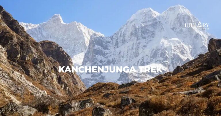
Lower Dolpo Trek reveals a hidden side of Nepal, where windswept valleys, ancient traditions, and remote mountain villages remain beautifully untouched.
Good experience with friendly tour guide and well arrangement,flexible and enjoyable.
Talk to an Expert (Hari)
The Lower Dolpo Trek is a remote, teahouse-based journey in the Dolpa District of Karnali Province in north-western Nepal. The trek route is known for its rugged landscapes, ancient culture, and untouched wilderness. Also, the trek follows old trade routes that were once used by traders traveling between Nepal and Tibet, crossing high passes, and walking through desert-like valleys, blue lakes, and traditional Tibetan isolated villages.
Lower Dolpo lies in the Dolpa district of western Nepal, about 300km northwest of Kathmandu, on the far side of the Dhaulagiri range. This restricted area requires restricted area permits, which keep the number of visitors low, helping preserve both the natural environment and the unique local culture. Most Lower Dolpo itineraries begin with flights from Kathmandu to Nepalgunj and then to Juphal, where the trek starts. The route passes through villages such as Dunai, Tarakot, Dho Tarap, Ringmo, and Shey Phoksundo Lake.
Further, a large part of the trek lies within Shey Phoksundo National Park. The Lower Dolpo Trek path leads you through huge river valleys, terraced fields, high yak pastures, and scattered stone villages with old monasteries, chortens, and prayer flags. Along the way, you may see blue sheep on the slopes, signs of snow leopards, and rare birds and wildlife in the higher forests.
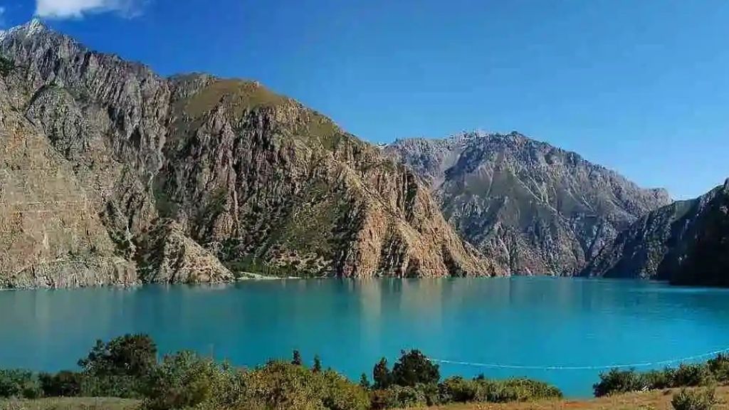
One of the biggest highlights of the trek is Shey Phoksundo Lake, famous for its striking turquoise water and spectacular mountain setting. Surrounded by steep cliffs and fed by waterfalls, the lake is considered one of the most beautiful natural attractions in Nepal. Nearby lies the Ringmo village, known for its stone houses, Tibetan-style culture, and the historic Thashung Gompa overlooking the lake.
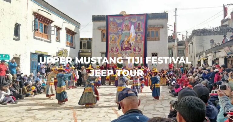
Culturally, Lower Dolpo is strongly influenced by Tibetan Buddhism and the older Bon tradition. In villages like Do-Tarap and Ringmo, you will see monasteries, mani walls, and prayer wheels, and if your timing is right, you may witness local festivals such as Lhosar or Chhewar. Daily life revolves around farming, yak herding, and trade, offering visitors a rare glimpse into a way of life that has remained largely unchanged for generations.
Nonetheless, the Lower Dolpo Trek is considered a challenging trek due to its remote location, high altitude, and long walking days. The altitude ranges from around 1,650m to over 5,000m and crosses demanding mountain passes such as Numa La Pass and Baga La Pass. It is best suited to experienced trekkers or very committed first-timers with good fitness. And since Dolpo lies in a rain-shadow region beyond the main Himalayan range, it is also one of the few trekking areas in Nepal that can be visited during the monsoon season. The best times to trek are spring (March to May) and late summer through autumn (August to October).
Make This Trek Your Next Adventure
Check available dates and start planning your Himalayan adventure with our trek experts.
Your Lower Dolpo adventure starts with a relaxed morning in Kathmandu, where you can enjoy breakfast and do any last checks on your gear. Later, our team will transfer you to the domestic terminal at Tribhuvan International Airport for the flight to Nepalgunj. The flight takes around 50 minutes and, on clear days, offers distant views of the Himalayan range and the rolling hills of western Nepal.
Nepalgunj lies close to the Indian border at about 150m above sea level and feels warm and humid compared to Kathmandu and Dolpo. After landing, you’ll check into a hotel and have time to freshen up. If time allows, you can take a short walk through the bazaar areas to see the busy streets, local markets, and diverse culture of the lowlands before resting for the night.
After you wake up and freshen up, you will have breakfast at your hotel and then quickly head towards Nepalgunj airport for our flight to Juphal. This short 45 minute flight takes you from the hot plains to the foothills of Dolpo, with impressive views of hills, deep valleys, and distant peaks as you approach the small airstrip. Juphal sits at around 2,850m and feels noticeably cooler than Nepalgunj.
From Juphal, you begin your first trekking day on the trail. You will gentle descent through terraced fields and small villages. Later, the path joins the bank of the Thuli Bheri River and follows it towards Dunai, the district headquarters of Dolpa. After 4 hours of walking, you reach Dunai, where you can explore the small town, visit the local monastery, and enjoy your first night in a mountain teahouse.
On the third day of the trek, you will begin your journey towards Tarakot after having breakfast at Dunai. You set out along the southern bank of the Thuli Bheri River. The Lower Dolpo Trek route today follows a well-trodden riverside trail that passes scattered houses, small fields, and groves of trees. You will walk through settlements like Lawan, where a suspension bridge takes you across the river, and see local people going about their daily lives.
As you gain distance, the valley widens, and you start to notice terraced fields of barley, buckwheat, and other crops. Near Tarakot, the trail reaches the confluence of the Barbung Khola and Tarap Chu rivers, creating a scenic meeting point of two waterways. Tarakot itself is a historic village whose name means “fortress” or “dzong”, and it once served as an important stop on the old salt trade route between Tibet and the lower valleys. You spend the night in a local teahouse, with time to wander the village lanes.
Today, the trail becomes a little steeper as you leave Tarakot and continue up the valley. The Lower Dolpo Trek path often stays above the river, at times climbing onto ridges and traversing slopes before dropping back to the water. You will cross suspension bridges and pass small clusters of houses, chortens, and mani walls that show the Buddhist influence in the region.
Along the way, you may see simple tea shops that serve tea, dal bhat, and basic snacks to trekkers and locals. Also, the landscape slowly shifts as the valley becomes narrower and more rugged. After around six hours of walking, you will arrive at Laini, a small settlement used by trekkers and local herders. Here you settle into a basic teahouse and rest for the next.
After an early breakfast, you climb towards a small pass at 3,540 m. The ascent is steady rather than very steep, and the top is decorated with prayer flags fluttering in the wind. This is a good spot for a short break and photos, as you can look back down the valley and ahead towards the wilder terrain of inner Dolpo.
From the pass, the trail continues high above the Tarap Chu (Tarap Khola). As you continue walking, the scenery becomes more barren and alpine, with fewer trees and more rocky slopes, shrubs, and grasses. In clear weather, you may glimpse snow-capped peaks of the Churen Himal area, including distant views of Putha Hiunchuli. Eventually, you descend to the river again and reach Nawar Pani. It is a remote trekking stop where facilities are simple, and many groups choose to camp or use very basic lodges. However, we will stay at a lodge here.
On day 6 of the Lower Dolpo Trek, you will follow the Tarap Chu river deeper into the heart of Dolpo. The Lower Dolpo Trek trail continues through a narrow gorge in places and crosses the river on wooden or suspension bridges where needed. As you continue higher, you will leave the last trees behind and enter sparse vegetation, juniper bushes, and wild rose shrubs.
Around midday, you will reach Kamattarka, near the junction where the Tarap Chu and Lang Khola meet. This is a natural rest spot, so you will stop here to enjoy a simple lunch as well as the scenery of the meeting rivers. After resting, you continue to Dho Tarap. You eventually reach Dho Tarap, a high village at around 4,090m. The village is home to people of Tibetan origin and the local Magar ethnic group. Many of them follow the pre-Buddhist Bon Po religion. You’ll notice women wearing black dresses and colorful aprons made from yak wool. You stay in a basic teahouse here.
Today is an acclimatization day at Dho Tarap to adjust to the altitude. In the morning, you can take a short hike above the village to follow the “climb high, sleep low” principle, helping your body adjust to the thinner air. Gentle walks around the valley, rather than full rest in bed, usually support better acclimatization.
The day is also a chance to explore Dho Tarap and its surroundings in more detail. You can visit Ribo Bumpa Monastery inside the village and the nearby Bon Gompa at Shipchowk, which shows the blend of Buddhist and Bon traditions. If you feel strong, a longer side trip to Drakmar Dewa Monastery, higher up the valley, offers wider views and a closer look at local religious life.
Throughout the day, you can meet villagers, learn about yak herding and farming, and see how the historic salt trade route to Tibet shaped local culture in this Dolpo region of Nepal. You return to the same lodge at Dho Tarap for a second night.
After resting for a day, you continue the trek as you aim to reach Numa La Base Camp today. The trek takes 6 hours and is more challenging than before. The trail passes small hamlets, stupas, and prayer flags, with mountain slopes rising on both sides. On the way, you will come across a unique school at a high altitude, which is named Crystal Mountain School. Many children wave to the trekkers in the area, and the sight is very pleasing.
As you continue moving for an hour from the school, you will reach today’s destination, which is the base of Numa La, one of the highest passes on the Lower Dolpo Trek. There is another Buddhist monastery in the Numa La Base Camp. Furthermore, there are no lodges and teahouses here, so you will stay overnight in a tent. Your guides and porters will set up a bonfire and a tent around the campsite and help you cook dinner.
This is one of the toughest but most rewarding days of the trek. You start early from Numa La Base Camp, climbing steadily on a zigzag trail towards the pass. The air is thin, and progress is slow, but with a steady pace, you reach Numa La Pass at around 5,309m. At the top of the Numa La Pass, the views stretch across rugged Dolpo terrain to peaks such as Dhaulagiri and parts of the Churen Himal.
Reaching Numa La Pass from the base camp area takes four hours. After soaking in the experience, you begin the long descent on the other side of the pass, which is easier than ascending the steep climb. You will follow the beautiful Gyambo Khola till you reach Danigar, a beautiful area of green meadows used by herders. There are no permanent teahouses, so you camp again tonight. The campsite, surrounded by mountains and grazing yaks, gives a real sense of being in the wild heart of Lower Dolpo. This way, days 8 and 9 feature Dho Tarap to Danigar via the Numa La Pass route.
On day 10, you start early once again to tackle your second major high pass. The trail climbs gradually from Danigar towards Baga La Base, then steepens as you approach the pass itself. At Baga La (5,169m), you are rewarded with far-reaching views of Norbung Kang, Kanjiroba Himal, and the dry, folded ridges of Dolpo. On clear days, you can also see Shey Phoksundo Lake far away.
After the pass, you descend towards Yak Kharka. Today’s destination is Yak Kharka, a pasture area used in the summer by local herders. Facilities here are very basic, sometimes with a very simple teahouse or shepherd shelter, but often camping is still the main option. You spend the night in this peaceful high pasture, with yaks and sheep grazing nearby.
Today’s walk is shorter and easier compared to the previous high-pass days. You start with a gradual descent through patches of forest and open slope, moving towards a lower altitude. Soon, you reach a viewpoint where Shey Phoksundo Lake suddenly comes into view far below, shining deep blue and turquoise against steep cliffs.
From here, you descend along the Phoksundo Khola and follow the path into Ringmo, a traditional Tibetan-style village on the lake’s southern shore. After checking into a lodge, you can walk to the edge of Shey Phoksundo Lake. This is one of the most memorable locations of the entire Lower Dolpo Trek. The lake is sacred, and swimming is not allowed. Above the water, you can see the Kanjirowa Himal massif. You can also visit
Today’s walk is shorter and easier compared to the previous high-pass days. You start with a gradual descent through patches of forest and open slope, moving towards a lower altitude. Soon, you reach a viewpoint where Shey Phoksundo Lake suddenly comes into view far below, shining deep blue and turquoise against steep cliffs.
From here, you descend along the Phoksundo Khola and follow the path into Ringmo, a traditional Tibetan-style village on the lake’s southern shore. After checking into a lodge, you can walk to the edge of Shey Phoksundo Lake. This is one of the most memorable locations of the entire Lower Dolpo Trek. The lake is sacred, and swimming is not allowed. Above the water, you can see the Kanjirowa Himal massif. You can also visit Tshowa Gompa, a Bon monastery that is around 900 years old. The day ends beside one of Nepal’s most important natural and cultural sites.
You spend a full day at Shey Phoksundo to rest and explore the unique atmosphere of this sacred lake. In the morning, you can stroll through Ringmo village, with its stone houses, narrow lanes, and mani walls. The locals here largely follow the Bon tradition, and you may see them spinning prayer wheels or tending to yaks and fields in their daily routines.
You can also visit Tshowa Gompa, a centuries-old Bon monastery located on a rocky spur above the lake. The short hike up offers excellent views over Shey Phoksundo and the surrounding cliffs. Another option is a short walk north to Jharana Waterfall, also called Phoksundo Waterfall. It drops about 330m and is one of the highest waterfalls in Nepal. The day is also good for rest and preparation. You rest well, check your gear, and enjoy the beautiful surroundings before continuing the journey.
Today’s trek take you from Phoksundo Lake to Shyanta. You start the day by hiking to a point above Ringmo village. This is the last chance to capture the lake’s beauty. From there, you trek downhill towards Polam and Chunuwar by passing winter grazing areas. Polam is a tiny village used by Ringmo villagers in winter. Likewise, Chunuwar is known for its traditional Amchi (Tibetan medicine) clinic and views of the waterfall.
The descent route of the Lower Dolpo region trek trail follows the Suli Gad River downstream, retracing part of the Lower Dolpo Trek path through forests and mixed terrain. You also pass small settlements such as Samduwa and Rechi. Wildlife such as monkeys, birds, and possibly blue sheep on distant slopes may be spotted along the way. By afternoon, you reach Shyanta, a small village where you stay in a simple teahouse and enjoy a warmer climate than the high valleys.
You begin the day following the Suli Gad River again. The trail leads you back to lower valleys and more populated areas. Along the way, you’ll pass the Sulighat check post, the official exit point for Shey Phoksundo National Park. Your Lower Dolpo Trek permits are checked here for the final time.
As you move away from the river, the landscape changes. You pass Kageni and Kalagaonda (Kala Gaura), where you see local farming and daily life that is different from the Tibetan-influenced culture in the higher valleys. From there, you’ll climb up to Juphal, where you can find the market, hotels, and restaurants. Finally, the day concludes with a farewell dinner to thank guides and porters for their support.
You start early for the morning flight from Juphal to Nepalgunj, as flights here are usually scheduled before midday due to changing winds and weather. The short flight offers one last look at the dramatic hills and valleys of Dolpo from the air. On arrival in Nepalgunj, you transfer to the next flight back to Kathmandu, usually with a short waiting time between the two.
The Nepalgunj–Kathmandu flight takes about 45 minutes, returning you to the bustle of the capital. Our staff will meet you at the airport and transfer you to your hotel in the city. Once in Kathmandu, your Lower Dolpo Trek comes to an official close. You can spend the rest of the day relaxing, shopping for souvenirs, or planning your next Himalayan adventure.
Ready to Plan Your Trek? Send an Inquiry
Not sure about the dates or details? No worries. Share your plans with us, and our trek expert will help you create the right trekking experience for you.
With our scheduled departures, you can explore the Himalayas without worrying about planning. We manage permits, accommodation, guides, and transport in advance so you can simply arrive and start your adventure.
The raw beauty of the Dolpo region was the reason for the success of the 1999 film Himalaya (also known as Caravan). It became the first Nepalese film to receive an Oscar nomination for Best Foreign Language Film. The film was shot entirely in the remote Dolpo region over nine months. It has captured Shey Phoksundo Lake and the region’s dangerous mountain passes.
French filmmaker Éric Valli cast local villagers, lamas, and chiefs instead of professional actors. The film also showed Bon Po and Tibetan traditions for a global audience. Every scene showed the reality of life in Dolpo’s rain-shadow region.
The Oscar nomination brought worldwide attention to Dolpo. Trekking in the region increased sixfold after the film, as travelers wanted to see the locations themselves. Further, the area’s cinematic appeal continues. In 2025, Dolpo continues to inspire filmmakers. The movie Shambhala, shot in similarly remote conditions, was the official entry of Nepal for the 97th Academy Awards.

Lower Dolpo’s remote location, trans-Himalayan landscapes, living salt trade heritage, basic infrastructure, complex logistics, strong Bon and Tibetan cultural life, and solitude differentiate Lower Dolpo from other trekking regions.
Ringmo and Dho Tarap are among the best places in Dolpo to see living Bon Po traditions. Bon Po is the indigenous spiritual practice of the Tibetan plateau, older than Tibetan Buddhism, with unique rituals, shrines, and local priests (bonpo).
As you walk through these traditional settlements, you’ll notice signs of Bon culture woven into the landscape. There are stone shrines, prayer walls, chortens, colorful prayer flags, and sacred sites throughout the villages and surrounding hillsides. Many of these places are still active, and local people gather to perform rituals, light butter lamps, chant prayers, and make offerings. If you visit during a ceremony or festival, you may hear traditional instruments such as drums and conch shells, which add to the region’s unique atmosphere.
The villages also offer a glimpse into traditional Himalayan lifestyles. You will see residents wearing Tibetan-style clothing, spinning prayer wheels as they walk, and following customs passed down through generations. Festivals, communal prayers, and seasonal ceremonies also play an important role in village life.
Required permits for the Lower Dolpo Trek include the Restricted Area Permit and the Shey Phoksundo National Park permit. A Restricted Area Permit is required because parts of Lower Dolpo are restricted trekking areas. This permit helps the Nepal government regulate visitor access, protect the region’s unique Tibetan-influenced culture, and conserve its fragile mountain environment. The permit must be arranged through a registered trekking agency.
Likewise, a Shey Phoksundo National Park permit is required, as most Lower Dolpo routes pass through it. The permit fee contributes to conservation, wildlife protection, and park management.
| Permit Type | Cost (Foreigners) |
| Lower Dolpo Restricted Area Permit (RAP) | USD 20 per person, per week, and USD 5 per additional day |
| Shey Phoksundo National Park Entry Permit | NPR 3,000 (USD 25-30) per person, per entry |
Note: Trekkers planning to film movies, commercials, or use large drones in Lower Dolpo must obtain separate filming permits and approvals from the Department of Tourism and Shey Phoksundo National Park authorities.
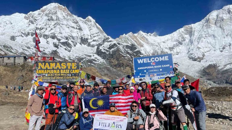
The Lower Dolpo Trek difficulty is graded as moderate to strenuous. It is less technical and slightly easier than the full Upper Dolpo circuit Trek, but is more demanding than popular trekking routes such as Annapurna Base Camp. The Lower Dolpo Trek difficulty results from remote locations, higher elevations, and limited infrastructure. Trekkers should be prepared for long days on the trail, often walking 5 to 7 hours per day, with some days requiring even longer hours.
A standard Lower Dolpo itinerary lasts around 15 days and covers approximately 150 to 200km, depending on the chosen route and weather conditions. The trek route passes through isolated landscapes where villages are often far apart. In some sections, trekkers spend nights camping between settlements with only their trekking crew nearby. And since the region is remote and sees only a few visitors, facilities and services are much more limited than on Nepal’s more established trekking trails.
Furthermore, rugged terrain and high altitude add to the physical challenge of the Lower Dolpo Trekking in Nepal. Most days, trekkers need to walk on rocky paths, scree slopes, loose ground, and steep switchbacks, and cross rivers on basic bridges. Not to mention, the crossing of Numa La Pass (5,309m) and Baga La Pass (5,169m) requires continuous climbs, good endurance, and careful footing. The high elevations can also make trekking more strenuous and require proper acclimatization.
Weather and environmental conditions add another layer of difficulty. Strong winds, sudden temperature drops, and rapidly changing mountain weather are common across Dolpo’s rain-shadow landscapes. In the event of an emergency, evacuation can take significantly longer than on busier trekking routes due to the region’s isolation. For these reasons, we say the Lower Dolpo Trek is suitable for trekkers with good physical fitness, previous multi-day hiking experience, and a willingness to accept basic facilities.
The Lower Dolpo Trek carries a moderate to high risk of altitude sickness (AMS). Symptoms can include headache, nausea, dizziness, fatigue, and loss of appetite. Severe cases can progress to HAPE (fluid in the lungs) or HACE (brain swelling), which are life-threatening. Altitude sickness can affect anyone, regardless of fitness, age, or previous trekking experience. The main risk factor is a rapid ascent. Acclimatization is the most effective way to prevent AMS.
Key strategies to reduce the risk of altitude sickness include:
No, you cannot trek to Lower Dolpo without a guide. Lower Dolpo is a restricted area, so you must be accompanied by a licensed trek guide. Previously, regulations also required a minimum group size of at least two trekkers, along with a guide. However, under updated rules introduced in March 2026, solo trekkers are now allowed, as long as they are accompanied by a licensed guide.
A guide is essential not only for legal reasons but also for safety and logistics. They help with route finding in remote areas, managing permits, arranging accommodation or camping, and handling unexpected situations in this very isolated region where facilities are limited.
The best times for a 15-day Lower Dolpo Trek are the autumn (September to November) and spring (March to May) seasons. These periods offer optimal weather conditions, stable temperatures, and the clearest mountain views, which are essential for this remote, high-altitude trek.
| Season | Months | Considerations |
| Autumn | Sep, Oct, Nov | Trails can be busier in October, and nights are cold at high altitudes. |
| Spring | Mar, Apr, May | Some high passes may still have snow in early spring (Mar/Apr), and late May can see some pre-monsoon haze or clouds. |
Tips: You can also choose the monsoon season (Jun to Aug) as an alternative, since Lower Dolpo lies in the Himalayan rain-shadow zone and receives very little rainfall.
Every spring from May to early June, local communities in Dolpo head into the high alpine meadows to collect Yarsagumba (Ophiocordyceps sinensis). It is a rare caterpillar fungus that is highly valued in traditional medicine. This seasonal harvest is an important source of income for local communities and can noticeably change the trekking experience in the region during spring.
The first impact is that during the harvest season, remote villages and alpine pastures become much busier as large numbers of collectors move into the mountains. As a result, teahouses, campsites, and local resources may be under greater demand, near major harvesting areas. Trekkers may also encounter more people on trails that are usually quiet and isolated.
At the same time, the harvest offers a unique opportunity to observe an important part of local life and understand how mountain communities earn a living in this remote region. In some areas, local authorities or community groups may introduce temporary rules or manage access to certain pasturelands during the peak collection period.
If your goal is to experience Lower Dolpo with fewer crowds and a quieter atmosphere, consider trekking in March, April, or late June onwards. It’s the time when most harvesting activity has ended and the trails return to their usual peaceful state.
Lower Dolpo is perfect for monsoon trekking because it lies in the Himalayan rain-shadow zone, where the high mountain ranges block much of the monsoon moisture, leaving the region dry or experiencing minimal rainfall during the summer monsoon months. While other trails can become muddy and affected by landslides, Dolpo offers stable conditions with only occasional rainfall. The landscape also becomes more vibrant during this period, with greener valleys, blooming alpine flowers, and colorful meadows contrasting beautifully against the region’s rugged mountains and desert-like terrain.
The monsoon season also brings fewer visitors. Thus, trekkers enjoy a quieter and more remote experience. Plus, trails, campsites, and villages are generally less crowded, adding to the sense of wilderness that makes Dolpo so special. Mornings are often clear, providing excellent views of the surrounding peaks before clouds occasionally build later in the day. Summer is also a good time for nature lovers, as wildlife is more active and high-altitude pastures are at their most colorful.
However, during the monsoon, trekkers should keep in mind that flights to and from Juphal often connect through Nepalgunj, and weather conditions elsewhere in Nepal can sometimes cause delays or schedule changes. For this reason, it is wise to include a few extra buffer days in your itinerary and remain flexible with travel plans.
Food and accommodation on the Lower Dolpo Trek are basic and simple compared to Nepal’s more popular trekking regions. However, they are generally sufficient to sustain trekkers comfortably during the journey. Talking about accommodation, in larger villages such as Dunai, Tarakot, Dho Tarap, and Ringmo, trekkers can stay in simple family-run teahouses. Rooms are twin-share with basic beds, foam mattresses, and blankets. Facilities are limited, with shared bathrooms, little or no heating, and electricity that often depends on solar power or generators. While the accommodation is simple, it is clean, comfortable, and operated by welcoming local families.
Likewise, some sections of the trek pass through very remote areas where teahouses are unavailable. In these places (Numa La Base Camp and Danigar), camping is required. Trekking crews set up tents, dining facilities, kitchen equipment, and other camping logistics. A warm sleeping bag and sleeping mat are highly recommended, especially during colder months.
At the same time, meals on the trek are simple, nutritious, and enough for long walking days. The most common meal is dal bhat (a traditional Nepali dish consisting of rice, lentil soup, and vegetable curry), which is served for both lunch and dinner. Breakfast options often include porridge, eggs, Tibetan bread, chapati, tea, and coffee.
Fresh meat is rarely available in the higher villages and may not always be stored under ideal conditions, so many trekkers prefer vegetarian meals. Since menu options can be limited in remote areas, bringing snacks such as energy bars, nuts, chocolate, or instant soups can add variety and provide extra energy during the trek.
Both Lower Dolpo and Upper Dolpo offer the best remote trekking experiences in Nepal, but they differ significantly in terms of trekking duration, difficulty, logistics, and cost. Now, let’s look at the differences briefly:
Lower Dolpo is the shorter and more accessible of the two regions. Most itineraries take between 14 and 18 days, with around 15 days being the most common. Depending on the route, trekkers cover 150 to 200km while crossing high passes and visiting villages such as Dho Tarap, Ringmo, and Shey Phoksundo Lake.
On the other hand, Upper Dolpo requires a much longer commitment. Most treks last 24 to 27 days or more, covering greater distances and spending more time at high altitude. The extra days are needed for acclimatization, remote travel, and exploring the vast plateaus that make Upper Dolpo famous.
Lower Dolpo is challenging but manageable for trekkers with good fitness. The route includes major passes such as Numa La (5,190 m) and Baga La (5,070 m), along with river valleys, high pastures, and dry mountain landscapes. The main challenges result from the remoteness, altitude, and long walking days rather than technical terrain.
Upper Dolpo is considerably more demanding. Trekkers spend longer periods above 4,000m, cross higher and more exposed terrain, and encounter harsher weather conditions. The routes pass through isolated plateaus and remote valleys where services are extremely limited.
The Lower Dolpo Trek begins with flights from Kathmandu to Nepalgunj and then to Juphal. The region requires restricted-area permits, but logistics are easier to manage, and some villages offer basic teahouse accommodation alongside camping options.
Upper Dolpo involves more complex planning. Permit requirements are stricter and significantly more expensive, while transportation and trekking logistics are more challenging. Trekkers usually need a larger support crew, more camping equipment, and additional preparation due to the remoteness of the region.
Lower Dolpo is already one of Nepal’s more expensive treks because of domestic flights, restricted-area permits, guides, porters, and camping support. However, the shorter duration helps keep overall costs lower than in Upper Dolpo.
Upper Dolpo is substantially more expensive. The longer itinerary, higher permit fees, larger support teams, and additional logistical requirements all increase the total trip cost. Also, trekkers should budget for extra contingency expenses and travel delays because of extreme remoteness.
Lower Dolpo offers a balance of spectacular scenery and cultural immersion. Trekkers visit traditional villages such as Dho Tarap and Ringmo, explore Shey Phoksundo Lake, and experience both fertile valleys and barren Trans-Himalayan landscapes. Trekkers can also have meaningful interactions with local communities.
Upper Dolpo delivers an even deeper wilderness experience. The landscapes are more isolated, the plateaus more dramatic, and the number of visitors much lower. Many trekkers consider it one of the last true expedition-style treks in Nepal.
For a trek in Lower Dolpo in 2026, packing requires a balance of lightweight gear and extreme-weather preparation. Here are the essentials presented clearly in a table.
| Category | Items | Details |
| Essential Clothing | Base Layers | Moisture-absorbing thermal tops and bottoms. Merino wool works best for odor control. |
| Insulation Layers | A down jacket rated to –15°C and a fleece or softshell jacket. | |
| Outer Shell | Waterproof and windproof GORE-TEX jacket and trousers for high passes. | |
| Trekking Clothes | 2–3 quick-dry hiking shirts and 1–2 convertible trekking pants. | |
| Footwear & Extrimities | Trekking Boots | Waterproof boots with good ankle support. Well broken in before the trek. |
| Camp Shoes | Sandals for camps and teahouses. | |
| Socks | 3–4 pairs of thick wool socks and two thin liner socks to prevent blisters. | |
| Gloves | One thin pair and one heavy waterproof insulated pair. | |
| Headwear | Wide-brim sun hat and warm wool or fleece beanie covering the ears. | |
| Technical Gear and Equipment | Backpack | 50–60L if carrying yourself or 30L daypack if using porters. |
| Sleeping Bag | 4-season bag rated to –20°C. Very cold at Numa La Base Camp. | |
| Trekking Poles | Highly recommended for descents from Baga La and Numa La. | |
| Headlamp | Essential for early starts and campsites. Carry spare batteries or a power bank. | |
| Health & Hygiene | Water Purification | LifeStraw, Katadyn filter, or purification tablets. |
| Sun Protection | SPF 50+ sunscreen, SPF lip balm, and Category 4 polarized sunglasses. | |
| Toiletries | Biodegradable soap, wet wipes, and a dry microfiber towel. | |
| Electronics & Documents | Power Bank | Solar charger or high-capacity power bank (20,000mAh or more). |
| Permits | Physical and digital copies of passport, permits, and insurance. | |
| Offline Maps | Download GPS maps like Gaia GPS or AllTrails. No mobile network on the trail. |
Plan Your Own Trek
Choose your dates, destinations, group size, budget, and preferences to create your ideal Himalayan adventure.
Good experience with friendly tour guide and well arrangement,flexible and enjoyable.
The views is amazing, we took many photo, the porter is helpfully good friendly always give us a happiness and support for trekking.
Discover the essential travel requirements for Nepal, including visa procedures, current travel restrictions, and health and safety guidelines. Our travel expert will guide you through the latest entry requirements based on your departure country and passport, ensuring you’re prepared for your Himalayan adventure.